

Around half the U.S. population live in coastal areas, at risk from a range of coastal hazards including hurricane winds and storm surge, floods, tornados, tsunamis and rising sea-level. While changes in sea-level occur over time scales measured in decades or more, other hazards such as hurricanes or tornados occur on timescales of days or hours, and early accurate predictions of their effects are crucial for planning and emergency response.
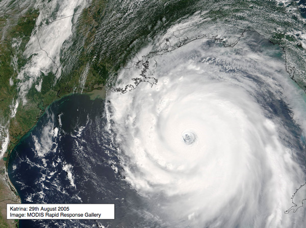
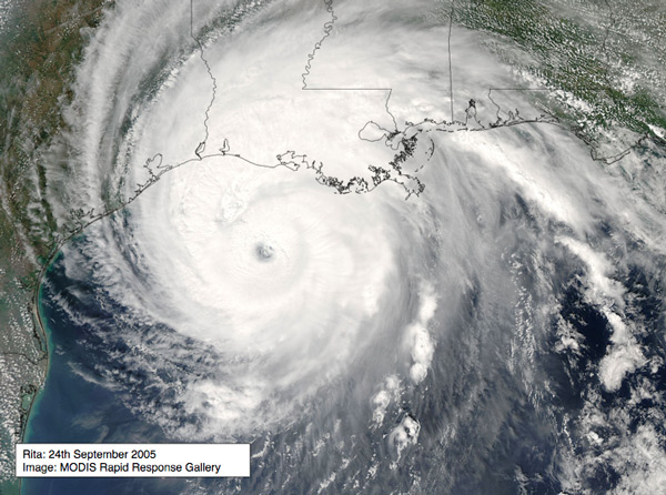
On the 29th August 2005, Hurricane Katrina (Fig. 1) hit New Orleans, with storm surge and flooding resulting in a tragic loss of life and destruction of property and infrastructure (Table 1). Soon after, Hurricane Rita caused similar devastation in the much less populated area of southwest Louisiana, and once again parts of New Orleans were under water. In both cases mandatory evacuations were enforced only 19 hours before the hurricanes made landfall. Speedier and more accurate analysis from prediction models could allow decision makers to evacuate earlier and with more preparation — and such hurricane prediction infrastructure is one goal of the SURA SCOOP Project.
The SCOOP Program1 2 is creating an open integrated network of distributed sensors, data and computer models to provide a broad array of services for applications and research involving coastal environmental prediction. At the heart of the program is a service-oriented cyberinfrastructure, which is being developed by modularizing critical components, providing standard interfaces and data descriptions, and leveraging new Grid technologies and approaches for dynamic data driven application systems3. This cyberinfrastructure includes components for data archiving, integration, translation and transport, model coupling and workflow, event notification and resource brokering.
| Hurricane Katrina | Hurricane Rita |
| Date: 23-30 Aug, 2005 | Date: 18-26 Sep, 2005 |
| Category 3 landfall (peak winds: 145 mph) on 29th Aug, 6:10 am CDT, near Buras LA. | Category 3 landfall (peak winds: 120 mph) on 24th Sep, 2:40 am CDT, Texas Louisiana Border. |
| Voluntary evacuation New Orleans: 37 hours before landfall. Mandatory evacuation: 19 hours before landfall. | Mandatory evacuation Galveston: 19 hours before landfall. |
| Human casualties: 1836 approx. Property damage: 120 billion, New Orleans population reduced by 50%. | Property damage: 35 billion, 10% population displaced from Houston and Galveston. |
| Storm size (width) at landfall: 460 miles Radius of hurricane force winds at landfall: 125 miles. Coastal storm surge: 18-22 feet. |
Storm size (width) at landfall: 410 miles Radius of hurricane force winds at landfall: 85 miles. Coastal storm surge: 15-20 feet. |
| Third most powerful hurricane to hit U.S coast. Most expensive. One of five deadliest. |


